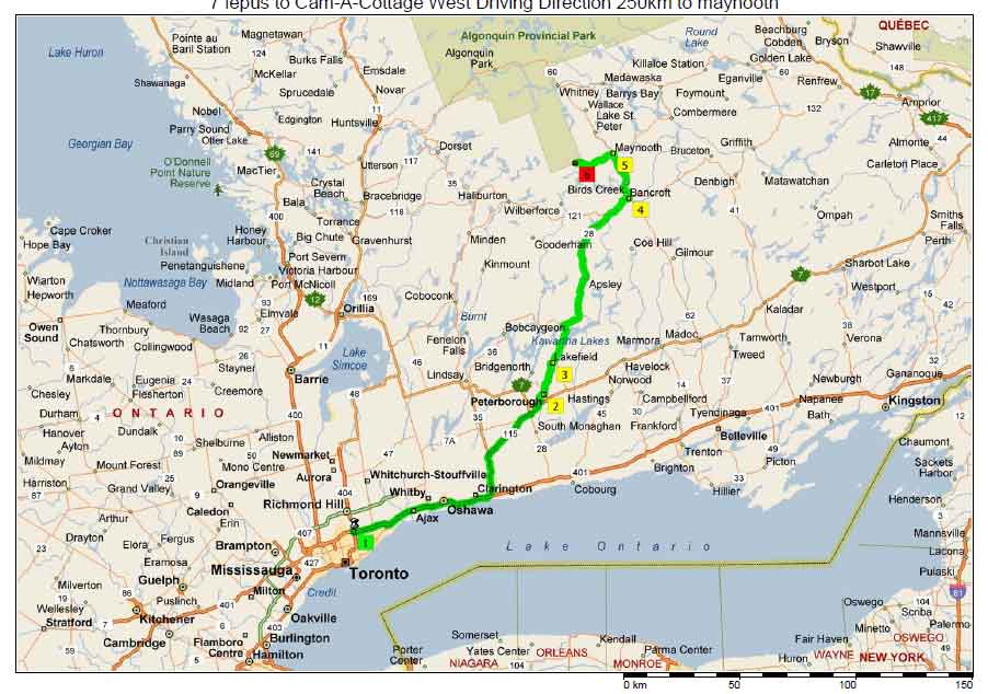
Plan of Fall Color Trip 2006 (感恩节长周末枫叶之旅 计划)This route plan is follow the suggestion from
http://www.400eleven.com/colour-report.html and other web information. It is expecting 460km driving from my north york home to Cottage near Kearnery, Ontario.
To get this route from Yahoo Map:
http://maps.yahoo.com/index.php#maxp=location&q10=45.667805,-79.203104&q9=Huntsville,+ontario&q8=45.096071,-78.745889&q7=haliburton,+ontario&q6=Wilberforce,+ontario&q5=45.084679,-78.148507&q4=45.187004,-78.167047&q3=maynooth,+ontario&q2=bancroft,+ontario&q1=7+lepus+starway,+toronto,+canada&mvt=m&trf=0&lon=-78.601685&lat=44.715514&mag=11
(Google map sucks, doesn't support multiple stops!)
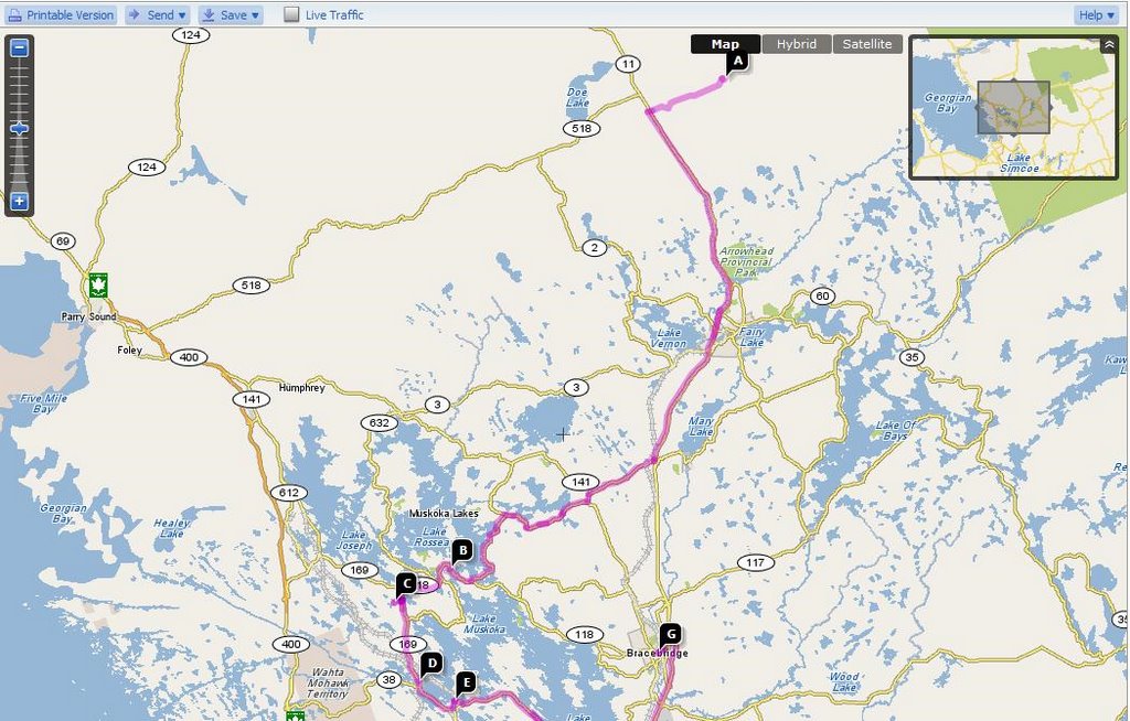
B. Bancroft
Eagle's Nest
A trip to Bancroft is not complete without a visit to the top of the Eagle's Nest for a panoramic view of the York river Valley below. There is a place to park at the top of the steep road that winds its way up to the lookout from Hastings Street North (Highway 62). This view is even more spectacular during the fall colours.
High FallsHigh falls Dam regulates the water level of beautiful Baptiste Lake. Take Highway 62 north from Bancroft for 7 kilometres to South Baptiste Lake Road, 2 kilometres west is the High Falls Road, a further 2 kilometres north brings to a 10 metre falls and dam site. It's a great place for picnicking, fishing for pickerel and hiking along riverside trails.
Egan ChuteEgan Chute is off of Highway 28 east, 10 kilometres from Bancroft. The Egan Chute area has recently been designated as a Provincial Park, although it remains undeveloped in a completely natural state. The York River crashes through its steep rock sides with a thundering roar spraying water. Corundum can also be found in occurrences along both sides of the trail leading down (north) to the chute.
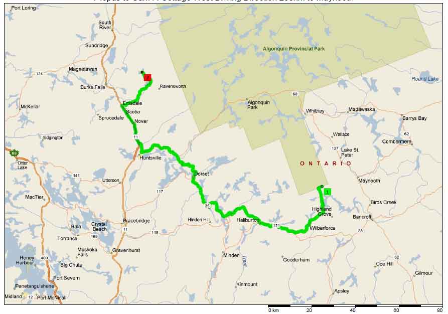
From
point C to D, we are going to drive along south side of Algonquin park.
From
point D to F, it is driving in the heart of Haliburton Highland, with lots of roadside lakes. Can't image what georgeous view will be there.
Stop at G for Buttermill Fall.

Pretty much later for the Day one, let heading to the cottage on point H.
(all my picture has been moved to picasa web album
http://picasaweb.google.com/ZouJianAlbum)
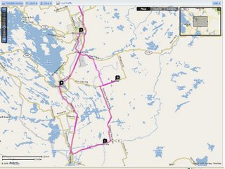
 Various routes has been suggested on Muskoka tourism wesites (http://www.discovermuskoka.ca). Most these routes are along lakeside, so enjoy the reflection of georgous color on the lake and don't blame me if your wife yell your bad driving!!!
